The Geomaps from the Verwandt site include a legend identifying the top ten Landkreise in which phone listings are present. These listings are fewer than, but proportional to the number of people with a given name. I do not completely understand the methodology as there are only two Landkreise in the legend with more than 10 entries, but the map shows three in red. (The ranking seems otherwise correct.) Additionally there are slight discrepancies with the maps from Geogen. Nonetheless, this is the best I have for now to help us identify where these folks lived.
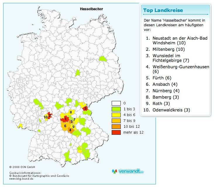
The major cluster surrounding the Aischgrund is easily explainable by what we know of the immigration from Austria in the mid 1600s. Interesting are the "red" Landkreise by Miltenberg, and in Winsiedel im Fichtelgebirge. I have not run into those place names before.
There are clusters near the big cities of Munich, Saarbrücken, Berlin, and Frankfort. (The Geogen maps include Hamburg as well.) This is not unexpected and does not necessarily imply that their families originated there.
These kinds of maps will undoubtedly stimulate additional research!